UN
158 Y Wern
£ 129,000
Description
We don't have a Description for this property.
- Bedrooms
- 3
- Bathrooms
- 0
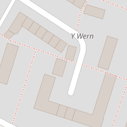

Leaflet © OpenStreetMap contributors
The heatmap indicates the level of crime in the area. The color of the heatmap indicates the crime severity and recency.
Metrics Year-on-Year
- Average area value
- 363,275.00 £Increased by 0.98 %
- Average area rental value
- 922.00 £/moDecreased by 1.28 %
- Est rental Yield
- 3.05 %Decreased by 2.24 %
- Crime Rate
- 13.00 %Unchanged by 0.00 %
from 359,732.00 £
from 934.00 £/mo
from 3.12 %
from 13.00 %
Nearby Schools
| Name | Type | Ofsted | Distance |
|---|---|---|---|
| Ysgol Cae'R Gwenyn | Welsh Establishment | 0.46 KM | |
| Gwenfro Community Primary School | Welsh Establishment | 0.56 KM | |
| St Anne'S R.C. Primary School | Welsh Establishment | 0.56 KM | |
| Hafod - Y - Wern Community Primary School | Welsh Establishment | 0.70 KM | |
| Ysgol Morgan Llwyd | Welsh Establishment | 1.20 KM |
Images
Nearby Streets
| Name | Average Price | Average Sqft | Distance |
|---|---|---|---|
| Windrush Close | £ 229,950 | 0 | 0.00 KM |
| Warwick Avenue | £ 160,000 | 0 | 0.00 KM |
| Barter Road | £ 0 | 0 | 0.00 KM |
| Meadow View | £ 110,000 | 0 | 0.00 KM |
| Newton Street | £ 165,000 | 0 | 0.00 KM |
Nearby Transport
| Name | NLC | TLC | Distance |
|---|---|---|---|
| Wrexham Central | 4486 | WXC | 2.65 KM |
| Wrexham General | 4487 | WRX | 3.12 KM |
| Gwersyllt | 4300 | GWE | 5.80 KM |
| Cefn-Y-Bedd | 2425 | CYB | 8.83 KM |
| Ruabon | 4477 | RUA | 9.63 KM |
Nearby Listings
| Address | Price | Type | Score | Distance |
|---|---|---|---|---|
| Y Wern, Wrexham | £ 140,000 | BUY | 6 / 10 | 0.12 KM |
| Connor Crescent, Wrexham, LL13 | £ 155,000 | BUY | 7 / 10 | 0.42 KM |
| Ashburn Way, Wrexham, LL13 | £ 235,000 | BUY | 6 / 10 | 0.45 KM |
| Ashburn Way, Wrexham | £ 240,000 | BUY | 6 / 10 | 0.45 KM |
| Ashburn Way, Wrexham, LL13 | £ 310,000 | BUY | Unknown | 0.46 KM |
Nearby Properties
| Address | Price | Distance |
|---|---|---|
| 158 Y Wern | £ 129,000 | 0.00 KM |
| 42 Queensway | £ 87,000 | 0.08 KM |
| 37 Queensway | £ 96,500 | 0.09 KM |
| 46 Queensway | £ 75,000 | 0.09 KM |
| 41 Queensway | £ 94,000 | 0.09 KM |